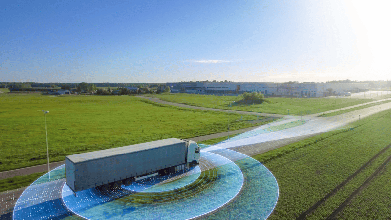
Geofencing has been used in logistics for years. As the technology becomes cheaper and more widespread, small carriers can use the same tools that mega carriers have been using to grow their business.
Learning to use these tools to automate processes and make better business decisions can help smaller carriers avoid burnout and start to grow comfortably. Geofences are an essential piece to measure your company's fleet utilization and maximizing your profitability.
What are geofences?
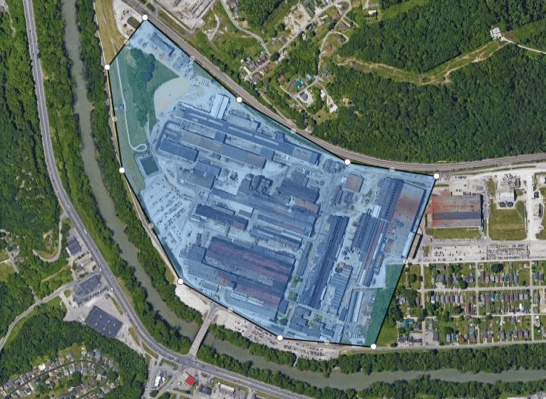
Geofences are virtual boundaries placed around a geographical location. GPS tracking with geofencing can log when a driver enters or exits the location.
Geofences can be any size or shape, so you can fence a single street, a parking lot, or a whole country.
Carriers can use this tool to log entry time, exit time, and any other important associated information tied to the asset or driver.
To make geofences work for your business, you have to use a telematics system to get the data. Telematics uses internet-connected devices to send GPS and other data to a server for use.
These devices can be dashcams or other video telematics systems, trailer-tracking units, and even some electronic logging devices.
There are dozens of ways that you can leverage a geofence to work for your specific needs. We will go through some of the methods that you can apply to your fleet management and business decisions.
Using geofences track task completion
Knowing when your assets enter or leave a geofenced area allows you to know when a specific action or task has been completed. Some places carriers monitor are:
- Loading sites
- Unloading sites
- Customer/Shippers
- Maintenance facilities
- Washout facilities
- Company yards or terminals
- Other areas where assets will “wait”
Setting alerts to know when an asset leaves these sites makes it easy to keep track of asset availability and utilization.
Some carriers use geofences for payroll management by marking job sites to track when drivers arrived to work and how many hours they worked.
Using Geofences to communicate next steps
Geofences can trigger workflow alerts to essential personnel to get tasks started as soon as possible.
Reminders and workflows help keep everyone aware of the next steps in their process. This can help form new habits for efficiency and keep objectives from being forgotten.
- Alert maintenance personnel that a truck with minor issues has arrived on site and should be pulled in for work
- Alert customers ahead of the driver’s arrival so they can get prepared for receipt to speed up unloading
- Email delivery notices so the customer can be notified and dispatch can send the driver to their next pickup
- Alert dispatch or drivers when a drop-and-hook trailer is ready for pickup
- Send drivers a reminder to scan paperwork when they arrive at a shipper
Using Geofences to measure vendor performance
Recording entry and exit time allows you to measure how long your driver or asset was inside a geofenced area. Measuring wait times, or dwell times, is essential for scheduling ahead. If you know your truck will be at a shipper for two hours waiting to load, you can schedule accordingly. You can also bill customers for excessively tying up your trucks.
Some wait times to monitor would be:
- How much time was spent waiting for trucks to be loaded or unloaded
- How long was your drop-and-hook trailer on site before you were notified it was ready for pickup
- The best arrival time at a certain site to get loaded more quickly
- How long a maintenance facility took to perform their work
A nice capability of geofences is grouping types of locations into color-coded function categories. As your fleet grows and works with more vendors you can easily segment sites into categories for comparison.
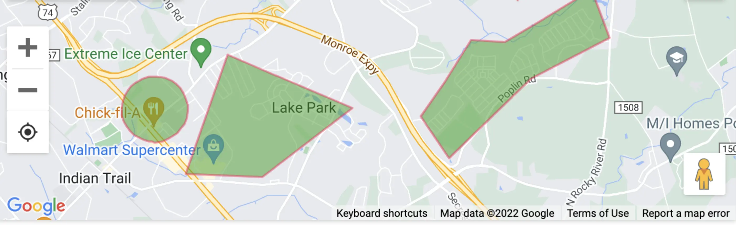
This level of visibility lets you answer important questions about who you’re doing business with.
- Is site A faster at turning trailers than site B? Why?
- Which site is more likely to get me loaded the fastest so I can make another pickup?
- Is it more efficient to send drivers to truck wash A or B?
Nesting geofences to shorten wait times
Nesting geofences is a technique that is used to measure when an asset was handed off to a customer, vendor, or other 3rd party, and how they handled the asset while they had it. Placing geofences around specific areas within a site can provide great details of when jobs are performed.
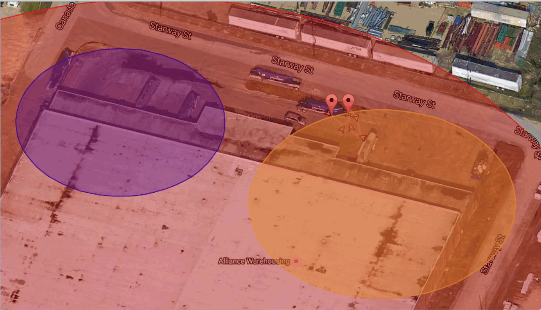
The image above is an example of nested geofences. In this example the entire site is inside a red geofence, with two smaller geofences around areas where different jobs are performed with hopper trailers.
This setup allows the trailer owner to track when a trailer arrived on site, when the trailer was moved into the area to be unloaded, when the trailer was moved into position for pickup, and when it was actually picked up and taken off site. This level of visibility helps you understand whether a bottleneck lies with the vendor or with your own pickup operations, and how to eliminate the bottleneck altogether.
Geofencing routes for monitoring and optimization
You can create a geofence along an entire route or a section of highway or city streets to keep an eye on delays and costs or when your assets are being driven off course.
Monitor two routes through an area to determine which is faster in normal conditions, and which is prone to traffic or delays.
Set boundaries around areas where heavy vehicles are restricted to get notified when your assets enter risky areas.
Leveraging IoT data to build on geofencing capabilities
The "Internet of Things" revolution has enabled the use of sensors to communicate with telematics devices. These sensors can add an extra layer to your fleet's visibility and provide a deeper level understanding about your fleet. Some of these IoT devices can monitor things such as:
- Suspension pressure for gross and axle weights
- Tire pressure
- Reefer temperatures
- Door sensors to tell if opened or closed
- pH sensors to measure acidity
Being able to get data on these types of sensors remotely can open up new possibilities in your fleet management. Adding this level of safety monitoring to your fleet pays dividends by avoiding loss, damage to cargo, and safety violations.
With gross and axle weights you can see how long your trucks are on site before they get loaded or unloaded. You can also see which shippers repeatedly overload your trucks.
Data from pH sensors can alert drivers of unsafe cargo so the customer can fix the problem before the driver takes possession and hauls something hazardous without a proper license.